Relief and hydrography
 (London from Primrose Hill, https://en.wikipedia.org/wiki/File:London_from_Primrose_Hill_May_2013.jpg)
Greater London is located 50 km west of the Thames Estuary and extends over an area of 579 km2 (37th worldwide).
The altitude there varies from sea level to 245 m (Biggin Hill, south of the metropolitan area).
The river, which crosses the city from west to east, had a major influence on the development of the city. London was originally founded on the north bank of the Thames and has, for several centuries, only one bridge, London Bridge. The main focus of the city is accordingly confined to this side of the Thames, until the construction, in the eighteenth century, of a series of other bridges. The city was then extended in all directions, this expansion being impeded by any natural obstacle, a campaign almost devoid of relief, with the exception of a few hills (Parliament Hill, Primrose Hill).
The Thames was once wider and shallower than today. The river banks were heavily decorated, most tributaries were diverted and are now underground, sometimes transformed into sewers (such as the Fleet river, whose name survives in Fleet Street, the oldest street newspapers). The Thames is subject to the tide and London is widely flood. Flood threats are increasing elsewhere over time given the steady rise of the water level at high tide and the slow tilting of Britain (bearing north, lowering south) caused by isostatic rebound phenomenon. A dam, the Thames Barrier was built across the Thames at Woolwich in the 1970s, to overcome this threat. In 2005 however, it was suggested the construction of a dam of about fifteen kilometers along further downstream in order to counter future flood risk.
PDF: https://www.telework.ro/en/e-books/geography-of-london/
Districts
 (Significant districts identified in the London Plan, http://wikitravel.org/en/File:Outer_London_districts.png)
London is often described by districts (for example, Bloomsbury, Mayfair, Whitechapel). These names have no official use but often designate parishes or city wards and remained in use by tradition, each referring to a separate district with its own characteristics but without official demarcation.
However, there is a central area of London that has a definition and a strict statute, the City of London. Often called simply the City, this is one of the global central business district. The City has its own governing body and its own borders, giving it a complete political and administrative autonomy. The new financial and commercial district of the docklands is located east of the City and is dominated by Canary Wharf. Another business area is located in the City of Westminster, which also houses the UK Government and Westminster Abbey.
West End is the main shopping area and includes the main attractions such as Oxford Street, Leicester Square, Covent Garden and Piccadilly Circus. West London includes posh residential areas such as Notting Hill, Knightsbridge district of Kensington and Chelsea where the average price of a house in certain neighborhoods is about 5.5 million pounds and where a house sold 60 million pounds. According to a 2007 ranking by the real estate group Knight Frank and Citi Private Bank, a subsidiary of Citigroup, London is the most expensive city in the world in the field of residential luxury real estate: 36.800 euros on average per square meter in this sector.
Another exclusive area is that of Hampstead in the District of Camden, where also live many of London figures.
The areas to the east of London include the East End and suburbs of Essex. These areas, located as close to the port of London, are known to have a high proportion of immigrants and for being one of the poorest in the capital. The area called East London is the birthplace of the industrial development in London. The many abandoned lands that today are found in full redevelopment, especially due the Thames Gateway project, which includes London Riverside and the Lower Lea Valley, which was able to host the Olympic Park and the Olympic Stadium of summer of 2012. North London and South London are also terms used to designate two areas of London separated by the Thames.
Climate
 (London in December 2013, https://en.wikipedia.org/wiki/File:View_of_London_by_David_Holt.jpg)
The London climate perfectly symbolizes the oceanic climate. Precipitation is regular throughout the year often in the form of drizzle, unlike in the west of the United Kingdom where they are of higher intensity. The average annual rainfall amounted to 622.5 mm, February being the driest months of the year. This level is lower than Rome or Sydney. London is actually one of the driest European capitals, with water resources per person below those of Israel, for example, the impression of bad weather comes mostly from the fact that annual sunshine is low. Such rainy cities but with a high sun do not produce the impression of bad weather found in London.
Summers are temperate, the hot days are rare and winters are cold but rarely icy. The hottest month is July with an average temperature in Kew Gardens 18.0 °C not exceeding 33 ° rarely, although higher levels have become more frequent recently, daytime summer temperatures usually vary between 20 and 25 °C. The highest temperature was 38.1 °C, measured in the Royal Botanic Gardens, Kew, on August10, 2003, during the heat wave of 2003. The coldest month is January with an average temperature of 2.4 °C to 7.9 °C. The coldest temperature was -16.1 °C on January 1, 1962 to Northolt.
Heavy snowfalls are almost unknown. In the most recent winters, snow has rarely exceeded one inch thick (less than 3 cm). This is mainly due to the fact that the vast London area creates a microclimate, with heat trapped by the buildings of the city. At night, the temperature is sometimes 5 to 9 °C higher than the surrounding areas. The famous London smog, fog and smoke mixture has become rare in the streets of the English capital. In 1954 he had caused 4,000 people to death.
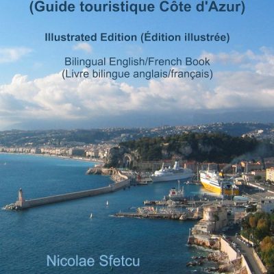
French Riviera Tourist Guide (Guide touristique Côte d’Azur)
Bilingual English/French Book (Livre bilingue anglais/français) French Riviera is one of the first modern resort areas. It began as a winter health resort at the end of the 18th century. With the arrival of the railway it became the playground … Read More

London: Business, Travel, Culture
London, the only city to have hosted the Olympics three times (1908, 1948, 2012), is dynamic and very diverse culturally. It plays an important role in art and fashion. It receives 28 million tourists per year and has four sites … Read More

Drobeta Turnu Severin – Mehedinti, Romania
The modern town of Drobeta Turnu Severin has a relatively new history. It made its appearance on the map of Romania and on that of the world following General Pavel Kiseleff’s decree on the 22nd of April, 1833. The town … Read More


Leave a Reply